File:Slrr map.png
Revision as of 16:16, 27 March 2012 by Balthazar Lindman (talk | contribs) (uploaded a new version of "File:Slrr map.png")
Size of this preview: 800 × 600 pixels. Other resolution: 1,200 × 900 pixels.
Original file (1,200 × 900 pixels, file size: 214 KB, MIME type: image/png)
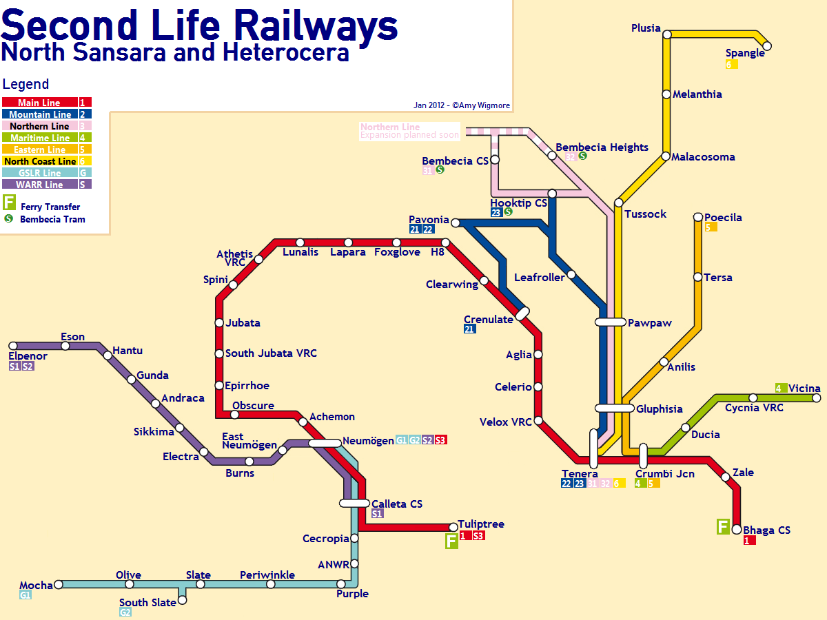
A fancy, schematized map of the Second Life Railroads, West Atoll Railroad, and Great Second Life Railway, complete with different routes and VRC stations.
Made by Amy Wigmore (balthazar.lindman), may be used for any purposes except selling.
File history
Click on a date/time to view the file as it appeared at that time.
| Date/Time | Thumbnail | Dimensions | User | Comment | |
|---|---|---|---|---|---|
| current | 16:16, 27 March 2012 | | 1,200 × 900 (214 KB) | Balthazar Lindman (talk | contribs) | |
| 16:15, 27 March 2012 |  | 1,200 × 900 (214 KB) | Balthazar Lindman (talk | contribs) | Made Neumögen route for S1 more explicit. | |
| 14:36, 27 March 2012 |  | 1,200 × 900 (181 KB) | Balthazar Lindman (talk | contribs) | A fancy, schematized map of the Second Life Railroads, West Atoll Railroad, and Great Second Life Railway, complete with different routes and VRC stations. Made by Amy Wigmore (balthazar.lindman), may be used for any purposes except selling. |
You cannot overwrite this file.
File usage
There are no pages that use this file.