Difference between revisions of "Grid Sector"
Kireji Haiku (talk | contribs) m (intra-wiki -links) |
|||
| Line 1: | Line 1: | ||
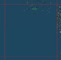
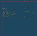
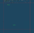
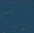
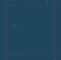
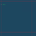
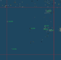
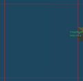
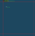
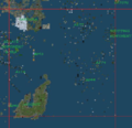
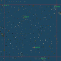
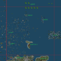
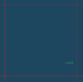
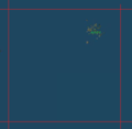
[[File:Grid Sectors.png|200px|thumb|right|Grid Sectors]] | [[File:Grid Sectors.png|200px|thumb|right|Grid Sectors]] | ||
A | A [[Grid Sector]] is an unofficial name given for a part of the grid (or world map). The name was invented by the [[Second Life Geography|Geography Of Second Life]] [[:Group:Geography Of Second Life|group]] while editing [[List Of Microcontinents And Sim Clusters]]. The system proved to be very effective for map orientation. | ||
== Size == | == Size == | ||
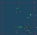
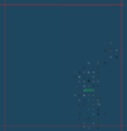
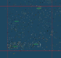
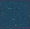
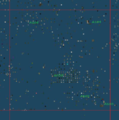
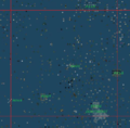
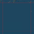
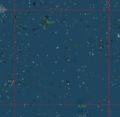
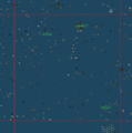
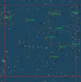
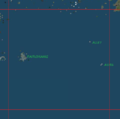
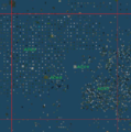
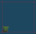
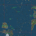
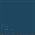
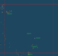
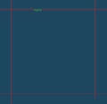
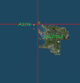
[[File:K10 census.png|200px|thumb|right|K10 sector and most of mainland continents]] | [[File:K10 census.png|200px|thumb|right|K10 sector and most of mainland continents]] | ||
A | A [[Grid Sector]] is a square with 100 sims length and 100 sims wide. In kilometers, that is about 25.6/25.6 km. It looks like the Linden officials use something similar for the grid map. When you scale the map to lowest resolution, image does not form in the same moment for all the map. Image is formed for different parts of the map, parts that have shape of a square. This means that, at lowest resolution, grid map texture is saved in squares of about 100/100 sims. | ||
An even smaller division is the [[Microsector]]. | An even smaller division is the [[Microsector]]. | ||
| Line 11: | Line 11: | ||
== Naming and coordinates == | == Naming and coordinates == | ||
The only way to define the position of a structure on the map is by using [[Coordinates]]. The coordinates are similar to those used by Gridsurvey[http://www.gridsurvey.com], in format ''longitude (min-max) /latitude (min-max)'' for a region of map and ''longitude/latitude'' for a single sim. The oldest sim, Da Boom, in [[Sansara]], has coordinates 1000/1000. | The only way to define the position of a structure on the map is by using [[Coordinates]]. The coordinates are similar to those used by Gridsurvey[http://www.gridsurvey.com], in format ''longitude (min-max) /latitude (min-max)'' for a region of map and ''longitude/latitude'' for a single sim. The oldest sim, Da Boom, in [[Sansara]], has coordinates <code>1000/1000</code>. | ||
Grid | [[Grid Sector]] are named with letters from left (West) to right (East) and with numbers from down (South) to up (North), exactly like the squares in a chess board. Theoretically, they start with grid sector <code>A1</code> and end with <code>T20</code>. In practice, many grid sectors are in fact void sectors. | ||
== Using grid sectors == | == Using grid sectors == | ||
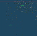
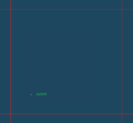
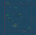
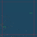
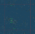
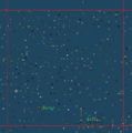
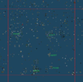
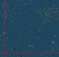
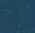
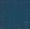
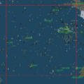
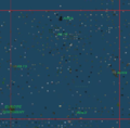
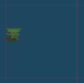
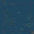
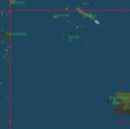
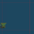
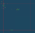
[[File:F12 census.png|200px|thumb|right|F11 sector contains many islands and structures]] | [[File:F12 census.png|200px|thumb|right|F11 sector contains many islands and structures]] | ||
Unlike coordinates, | Unlike [[Coordinates|coordinates]], it is much simpler to manage and understand a [[Grid Sector|grid sector's]] position. It is a much easier way to find the position of a [[Continent]], [[Subcontinent]], [[Microcontinent]], [[Sim Cluster]], [[Sim Group]] or [[Isolated Sim]] using a [[Grid Sector]]. | ||
== Useful scripts == | == Useful scripts == | ||
The following script can tell you your | The following script can tell you your [[Coordinates]], sim name and [[Grid Sector]]. put it into a HUD prim or an item you wear and when you touch it, you will know where you are: | ||
<lsl> | <lsl> | ||
//Created by Ana Imfinity | //Created by Ana Imfinity | ||
list | list sectors = [ | ||
"J", "K", "L", "M", "N", "O", "P", "Q", "R", "S", "T", "U", "V", "W"]; | "zero", "A", "B", "C", "D", "E", | ||
"F", "G", "H", "I", "J", "K", | |||
"L", "M", "N", "O", "P", "Q", | |||
"R", "S", "T", "U", "V", "W"]; | |||
default | default | ||
{ | { | ||
touch_start(integer num_detected) | |||
{ | { | ||
vector regionCorner = llGetRegionCorner(); | |||
// 0x100 = 2^8 (2 power 8) = 256 | |||
vector | |||
integer grid_x = (integer)(regionCorner.x/0x100); | |||
integer grid_y = (integer)(regionCorner.y/0x100); | |||
integer | |||
integer | integer column_number = (integer)(grid_x/100); | ||
integer | string column = llList2String(sectors, column_number); | ||
integer | integer row = (integer)(grid_y/100); | ||
string sim = llGetRegionName(); | string sim = llGetRegionName(); | ||
string | |||
string output = "Current grid position: (" | |||
+ (string)grid_x + ", " + (string)grid_y | |||
llOwnerSay( | + ")\n\tGrid sector:\t " + column + (string)row | ||
+ "\n\tSim name:\t\t '" + sim + "'"; | |||
llOwnerSay(output); | |||
} | } | ||
} | } | ||
// Example output: | |||
// | |||
// Current grid position: (1023, 1007) | |||
// Grid sector: J10 | |||
// Sim name: 'Help Island Public' | |||
</lsl> | </lsl> | ||
| Line 226: | Line 239: | ||
== Download == | == Download == | ||
To download maps of grid sectors and oceans, use | To download maps of grid sectors and oceans, use [https://mega.co.nz/#F!OJMAHBYC!EtkGzGon19wtXaA7NNRPGQ this link]. The information is stored on [http://www.megs.co.nz Mega], the succesor of Megaupload, probably the most secure data storage & transfer system. You need Google Chrome to download. | ||
== See also == | == See also == | ||
Revision as of 13:07, 14 January 2014

A Grid Sector is an unofficial name given for a part of the grid (or world map). The name was invented by the Geography Of Second Life group while editing List Of Microcontinents And Sim Clusters. The system proved to be very effective for map orientation.
Size

A Grid Sector is a square with 100 sims length and 100 sims wide. In kilometers, that is about 25.6/25.6 km. It looks like the Linden officials use something similar for the grid map. When you scale the map to lowest resolution, image does not form in the same moment for all the map. Image is formed for different parts of the map, parts that have shape of a square. This means that, at lowest resolution, grid map texture is saved in squares of about 100/100 sims.
An even smaller division is the Microsector.
Naming and coordinates
The only way to define the position of a structure on the map is by using Coordinates. The coordinates are similar to those used by Gridsurvey[1], in format longitude (min-max) /latitude (min-max) for a region of map and longitude/latitude for a single sim. The oldest sim, Da Boom, in Sansara, has coordinates 1000/1000.
Grid Sector are named with letters from left (West) to right (East) and with numbers from down (South) to up (North), exactly like the squares in a chess board. Theoretically, they start with grid sector A1 and end with T20. In practice, many grid sectors are in fact void sectors.
Using grid sectors

Unlike coordinates, it is much simpler to manage and understand a grid sector's position. It is a much easier way to find the position of a Continent, Subcontinent, Microcontinent, Sim Cluster, Sim Group or Isolated Sim using a Grid Sector.
Useful scripts
The following script can tell you your Coordinates, sim name and Grid Sector. put it into a HUD prim or an item you wear and when you touch it, you will know where you are:
<lsl> //Created by Ana Imfinity list sectors = [
   "zero", "A", "B", "C", "D", "E",
   "F", "G", "H", "I", "J", "K",
   "L", "M", "N", "O", "P", "Q",
   "R", "S", "T", "U", "V", "W"];
default {
   touch_start(integer num_detected)
   {
       vector regionCorner = llGetRegionCorner();
// 0x100 = 2^8 (2 power 8) = 256
       integer grid_x = (integer)(regionCorner.x/0x100);
       integer grid_y = (integer)(regionCorner.y/0x100);
       integer column_number = (integer)(grid_x/100);
       string  column        = llList2String(sectors, column_number);
       integer row           = (integer)(grid_y/100);
string sim = llGetRegionName();
       string output = "Current grid position: ("
                   + (string)grid_x + ", " + (string)grid_y
                   + ")\n\tGrid sector:\t   " + column + (string)row
                   + "\n\tSim name:\t\t '" + sim + "'";
       llOwnerSay(output);
   }
}
// Example output: // // Current grid position: (1023, 1007) // Grid sector: J10 // Sim name: 'Help Island Public' </lsl>
List of grid sectors
Sectors
This list contains also their Coordinates:
- D6, 400-500/600-700
- D7, 400-500/700-800
- D8, 400-500/800-900
- D9, 400-500/900-1000
- D10, 400-500/1000-1100
- D11, 400-500/1100-1200
- D12, 400-500/1200-1300
- D13, 400-500/1300-1400
- D14, 400-500/1400-1500
- D15, 400-500/1500-1600
- D16, 400-500/1600-1700
- E5, 500-600/500-600
- E6, 500-600/600-700
- E7, 500-600/700-800
- E8, 500-600/800-900
- E9, 500-600/900-1000
- E10, 500-600/1000-1100
- E11, 500-600/1100-1200
- E12, 500-600/1200-1300
- E13, 500-600/1300-1400
- E14, 500-600/1400-1500
- E15, 500-600/1500-1600
- F8, 600-700/800-900
- F9, 600-700/900-1000
- F10, 600-700/1000-1100
- F11, 600-700/1100-1200
- F12, 600-700/1200-1300
- F13, 600-700/1300-1400
- F14, 600-700/1400-1500
- G6, 700-800/600-700
- G7, 700-800/700-800
- G8, 700-800/800-900
- G9, 700-800/900-1000
- G10, 700-800/1000-1100
- G11, 700-800/1100-1200
- G12, 700-800/1200-1300
- G13, 700-800/1300-1400
- G14, 700-800/1400-1500
- H8, 800-900/800-900
- H9, 800-900/900-1000
- H10, 800-900/1000-1100
- H11, 800-900/1100-1200
- H12, 800-900/1200-1300
- H13, 800-900/1300-1400
- H14, 800-900/1400-1500
- I5, 900-1000/500-600
- I7, 900-1000/700-800
- I8, 900-1000/800-900
- I9, 900-1000/900-1000
- I10, 900-1000/1000-1100
- I11, 900-1000/1100-1200
- I12, 900-1000/1200-1300
- I13, 900-1000/1300-1400
- I14, 900-1000/1400-1500
- J4, 1000-1100/400-500
- J5, 1000-1100/500-600
- J7, 1000-1100/700-800
- J8, 1000-1100/800-900
- J9, 1000-1100/900-1000
- J10, 1000-1100/1000-1100
- J11, 1000-1100/1100-1200
- J12, 1000-1100/1200-1300
- J13, 1000-1100/1300-1400
- J14, 1000-1100/1400-1500
- K10, 1100-1200/1000-1100
- K11, 1100-1200/1100-1200
- K12, 1100-1200/1200-1300
- K13, 1100-1200/1300-1400
- L9, 1200-1300/900-1000
- L11, 1200-1300/1100-1200
- L12, 1200-1300/1200-1300
- L13, 1200-1300/1300-1400
- M10, 1300-1400/1000-1100
- M11, 1300-1400/1100-1200
- M12, 1300-1400/1200-1300
- M13, 1300-1400/1300-1400
- Q12, 1700-1800/1200-1300
- R11, 1800-1900/1100-1200
- R12, 1800-1900/1200-1300
Rows & Columns
Just like at a chess board, grid sectors form squares that can be grouped into 13 rows (from 4 to 16) and 12 columns (from D to M, plus Q and R).
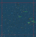
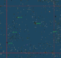
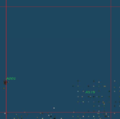
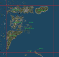
Gallery
D6
D7
D8
D9

D10
D11
D12
D13
D14
D15
D16
E5

E6
E7
E8
E9
E10
E11
E12
E13
E14
E15
F8
F9
F10
F11
F12
F13
F14
G6
G7
G8
G9
G10
G11
G12
G13
G14
H8
H9
H10
H11
H12
H13
H14
I5
I7
I8
I9
I10
I11
I12
I13
I14
J4
J5
J7
J8
J9
J10
J11
J12
J13
J14
K9
K10
K11

K12
K13
L9

L11
L12
L13
M10
M11
M12
M13
Q12, R11, R12


Download
To download maps of grid sectors and oceans, use this link. The information is stored on Mega, the succesor of Megaupload, probably the most secure data storage & transfer system. You need Google Chrome to download.
See also
List Of Microcontinents And Sim Clusters - includes detalied data for all grid sectors
Oceans - additional information can be found here, including links to all oceans
Da Boom - the oldest sim and center of coordinates system