User:Daniel Voyager/tsl maps: Difference between revisions
Jump to navigation
Jump to search

Whats what? 
TSL Map in 2004 
TSL Map in 2005 
TSL Map in 2006-07 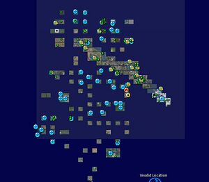
TSL Map in May 2008 
TSL Map in June 2008
mNo edit summary |
mNo edit summary |
||
| Line 6: | Line 6: | ||
[[Image:TG Map 2004.jpg|centre|thumb|TSL Map in 2004]] | [[Image:TG Map 2004.jpg|centre|thumb|TSL Map in 2004]] | ||
* Really old map of the Teen Grid while in beta | |||
[[Image:TG Map 2005.jpg|centre|thumb|TSL Map in 2005]] | [[Image:TG Map 2005.jpg|centre|thumb|TSL Map in 2005]] | ||
* Mainland overview look | |||
[[Image:TG Map 2007.jpg|centre|thumb|TSL Map in 2006-07]] | [[Image:TG Map 2007.jpg|centre|thumb|TSL Map in 2006-07]] | ||
| Line 18: | Line 18: | ||
[[Image:TG June Map 2008.jpg|centre|thumb|TSL Map in June 2008]] | [[Image:TG June Map 2008.jpg|centre|thumb|TSL Map in June 2008]] | ||
* New added content: TG Bay City Sims to the left of the grid, mainland now looks big. | |||
Revision as of 01:18, 10 June 2008
TSL Maps 2004 - 2008

- This shows the Teen-grid wide reorganization to group like islands with like: teen with teen, Linden with Linden, and adult with adult.

- Really old map of the Teen Grid while in beta

- Mainland overview look


- New added content: TG Bay City Sims to the left of the grid, mainland now looks big.