Difference between revisions of "Eastern Ocean"
| Line 17: | Line 17: | ||
=== North Basin === | === North Basin === | ||
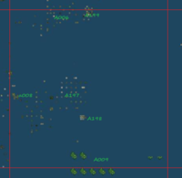
[[File:K12 census.png|200px|thumb|left|[[Grid Sector]] K12]] | |||
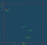
[[File:K13 census.png|200px|thumb|right|[[Grid Sector]] K13]] | |||
This includes some parts of the map in North - East. The islands in that part have the highest density in the Eastern Ocean, but still are more rare then in other parts of the grid (like [[Northern Ocean]] or [[Western Ocean]]. Sim density drops gradually from West to East. A lot of void spaces appear between diverse sim structures. | This includes some parts of the map in North - East. The islands in that part have the highest density in the Eastern Ocean, but still are more rare then in other parts of the grid (like [[Northern Ocean]] or [[Western Ocean]]. Sim density drops gradually from West to East. A lot of void spaces appear between diverse sim structures. It coveres many grid sectors: K11, K12 and K13. Even if it represents only 20% of the ocean surface, it concentrates more then 60% of its sims: | ||
*[[Grid Sector]] '''K11''', coordinates 1100-1200/1100-1200, sector full of sims | |||
**A009! (LR sims) - [[Microcontinent]] - 1139-1366/1196-1210 - A group of 7 identical microcontinents | |||
**A010 (EduFinland) - [[Microcontinent]] - 1138-1144/1182-1185 - Northern Ocean | |||
**A050! (Serena) - [[Sim Cluster]] - 1185-1215/1133-1150 - the largest sim cluster, see below | |||
**A051 - [[Sim Cluster]] - 1173-1179/1167-1181 - East Ocean | |||
**A few [[Unassociated Sims]] are present. | |||
*[[Grid Sector]] '''K12''', 1100-1200/1200-1300, more then half of the sector is void | |||
**A006 (University) - [[Sim Cluster]] - 1147-1153/1294-1302 - Far North Ocean | |||
**A008 (TAMHSC) - [[Microcontinent]] - 1102-1105/1244-1246 - Northern Ocean | |||
**A009! (LR sims) - [[Microcontinent]] 1139-1366/1196-1210 - A group of 7 identical microcontinents | |||
**A197 - [[Sim Cluster]] - 1126-1145/1237-1257, Northern Ocean, institution estate owned | |||
**A198 (ITE) - [[Microcontinent]] - 1145-1148/1231-1233, Northern Ocean | |||
**A199! (Science) - [[Microcontinent]] + [[Sim Cluster]] - 1145-1151/1294-1302, Far North Ocean | |||
**No [[Unassociated Sims]] exist in this sector. | |||
*[[Grid Sector]] '''K13''', 1100-1200/1300-1400, largest part of this sector is void | |||
**A007 - [[Sim Cluster]] - 1155-1168/1307-1317 - ( parts with no access) | |||
**A055 (Austria) - [[Microcontinent]] - 1104-1110/1382-1388 - Far North Ocean | |||
**A199! (Science) - [[Microcontinent]] + [[sim Cluster]] - 1145-1151/1294-1302, Far North Ocean | |||
**A200 (TAMUCC) - isolated sim - 1162-1330 - Far North Ocean | |||
**A201 (Atlantic Games) [[Sim Group]] - 1141-1144/1340-1342 - Far North Ocean, includes 4 sims, 2 are connected | |||
**A few [[Unassociated Sims]] are present in the sector. | |||
Majority of these sims (if not all) are owned by institutions (universities, for example). It looks like the teen grid has moved here. Majority of the estates allow public access to their lands, but some of them don't. Here, you can find everything you want for learning, from classrooms, amphitheaters, laboratories and campuses to places dedicated to science or science-fiction. | |||
The LR sims, a group of 7 identical microcontinents, are showen on the [[List Of Microcontinents And Sim Clusters]] with temporary name A009. Their position has changed a bit in time. They have no access to public. Most probably, they are used for testing new products and viewers. | |||
=== Gaeta Sea === | === Gaeta Sea === | ||
| Line 26: | Line 54: | ||
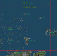
There is a gap between [[Gaeta 1]] and [[Corsica]]. It is unknown what was the initial plan for the Gaeta Supercontinent, we only know that the project is abandoned. The grid area between Gaeta 1 and Corsica now is filled with sims. Also, the space in West of Gaeta 1 is full of private sims. The name is unofficial. It comes from its position on the map. I named this place ''West Gaeta Sea'', but soon after this naming, someone suggested me that it's better to call it ''Gaeta Sea''. | There is a gap between [[Gaeta 1]] and [[Corsica]]. It is unknown what was the initial plan for the Gaeta Supercontinent, we only know that the project is abandoned. The grid area between Gaeta 1 and Corsica now is filled with sims. Also, the space in West of Gaeta 1 is full of private sims. The name is unofficial. It comes from its position on the map. I named this place ''West Gaeta Sea'', but soon after this naming, someone suggested me that it's better to call it ''Gaeta Sea''. | ||
Borders are clearly visible to South and East, but in North and Wset, the separation limit is not clear. | Borders are clearly visible to South and East, but in North and Wset, the separation limit is not clear. In north, the sea is continued with the Northern Basin. | ||
This small sea fills inside a single grid sector: | This small sea fills inside a single grid sector: | ||
Revision as of 02:13, 23 October 2013
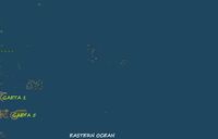
Eastern Ocean includes a large part of the grid map, East to the large mainland continents. It has a very low sim density. The islands composing it can easy be divided into remote seas. Name is not official, it comes from its map position to the mainland continents. However, this name was previously suggested in ContinentDetector.
Borders, sectors and coordinates
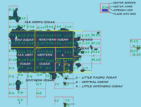
To West, the border is formed by the continents Corsica, Nautilus, Satori and Shopping Continent. The western border can be considered the line between grid sectors J11 and K11. In North and South, it extends as far as the last isolated sim. To East, it vanishes at the last sim, somewhere at the half distance between Corsica and Zindra.
The ocean coveres many grid sectors (see Grid Sector): K9, K10, M10, K11, L11, M11, K12, L12, M12, K13, L13, M13. With 13 grid sectors, Eastern Ocean is the larger ocean of the grid. Even if it is so large, it concentrates only a small number of sims.
Coordinates are given in sims, format longitude (min-max)/latitude (min-max), as given for every sim at Gridsurvey[1]. Previously given coordinates were 1179-1500/500-1500. Now, best coordinates are 1100-1400/900-1400.
Geography
This large ocean can be divided into many subdivisions. Previously, some divisions were allready shown.
North Basin
This includes some parts of the map in North - East. The islands in that part have the highest density in the Eastern Ocean, but still are more rare then in other parts of the grid (like Northern Ocean or Western Ocean. Sim density drops gradually from West to East. A lot of void spaces appear between diverse sim structures. It coveres many grid sectors: K11, K12 and K13. Even if it represents only 20% of the ocean surface, it concentrates more then 60% of its sims:
- Grid Sector K11, coordinates 1100-1200/1100-1200, sector full of sims
- A009! (LR sims) - Microcontinent - 1139-1366/1196-1210 - A group of 7 identical microcontinents
- A010 (EduFinland) - Microcontinent - 1138-1144/1182-1185 - Northern Ocean
- A050! (Serena) - Sim Cluster - 1185-1215/1133-1150 - the largest sim cluster, see below
- A051 - Sim Cluster - 1173-1179/1167-1181 - East Ocean
- A few Unassociated Sims are present.
- Grid Sector K12, 1100-1200/1200-1300, more then half of the sector is void
- A006 (University) - Sim Cluster - 1147-1153/1294-1302 - Far North Ocean
- A008 (TAMHSC) - Microcontinent - 1102-1105/1244-1246 - Northern Ocean
- A009! (LR sims) - Microcontinent 1139-1366/1196-1210 - A group of 7 identical microcontinents
- A197 - Sim Cluster - 1126-1145/1237-1257, Northern Ocean, institution estate owned
- A198 (ITE) - Microcontinent - 1145-1148/1231-1233, Northern Ocean
- A199! (Science) - Microcontinent + Sim Cluster - 1145-1151/1294-1302, Far North Ocean
- No Unassociated Sims exist in this sector.
- Grid Sector K13, 1100-1200/1300-1400, largest part of this sector is void
- A007 - Sim Cluster - 1155-1168/1307-1317 - ( parts with no access)
- A055 (Austria) - Microcontinent - 1104-1110/1382-1388 - Far North Ocean
- A199! (Science) - Microcontinent + sim Cluster - 1145-1151/1294-1302, Far North Ocean
- A200 (TAMUCC) - isolated sim - 1162-1330 - Far North Ocean
- A201 (Atlantic Games) Sim Group - 1141-1144/1340-1342 - Far North Ocean, includes 4 sims, 2 are connected
- A few Unassociated Sims are present in the sector.
Majority of these sims (if not all) are owned by institutions (universities, for example). It looks like the teen grid has moved here. Majority of the estates allow public access to their lands, but some of them don't. Here, you can find everything you want for learning, from classrooms, amphitheaters, laboratories and campuses to places dedicated to science or science-fiction.
The LR sims, a group of 7 identical microcontinents, are showen on the List Of Microcontinents And Sim Clusters with temporary name A009. Their position has changed a bit in time. They have no access to public. Most probably, they are used for testing new products and viewers.
Gaeta Sea
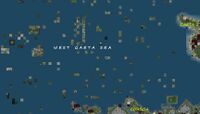
There is a gap between Gaeta 1 and Corsica. It is unknown what was the initial plan for the Gaeta Supercontinent, we only know that the project is abandoned. The grid area between Gaeta 1 and Corsica now is filled with sims. Also, the space in West of Gaeta 1 is full of private sims. The name is unofficial. It comes from its position on the map. I named this place West Gaeta Sea, but soon after this naming, someone suggested me that it's better to call it Gaeta Sea.
Borders are clearly visible to South and East, but in North and Wset, the separation limit is not clear. In north, the sea is continued with the Northern Basin.
This small sea fills inside a single grid sector:
- Grid SectorK11, 1100-1200/1100-1200, sector full of sims
Structures
- A047 - Sim Cluster + Microcontinent - 1103-1109/1119-1129 - West Gaeta Sea
- A188 - Sim Cluster - 1090-1148/1130-1174 - West Gaeta Sea + Northern Ocean
- Many Unassociated Sims exist, close to the continental shores.
These sims are not one like the other. Their population density is much higher then Gaeta 1 and still higher then Corsica. Some islands have no public access.
Serena
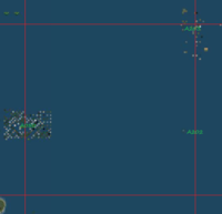
Serena is one of the largest Sim Cluster of the grid. It stands inside two grid sectors, K11 and L11 and is separated of other structures by large void spaces. It is owned by a single estate. All sims that form it, are in contact one to another on their diagonals, so it is impossible to travel from one to another without teleporting. On List Of Microcontinents And Sim Clusters, Serena received also a temporary name, A050:
A050! (Serena) - Sim Cluster - coordinates: 1185-1215/1133-1150 - East Ocean, the largest sim cluster
Sims without public access, if they exist, they are very rare. However, you might easy find parcels protected by an entity orb. Ban lines are not used often. Many islands look like tropical beach paradise, but not all. They have different maturity levels, different textures and different types of buildings.
A trip through Serena Islands is an experience where you find a lot of diversity.
Sharp Islands
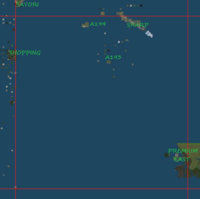
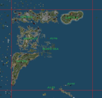
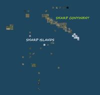
These islands are what is left from the old teen grid. Now, they are reduced to a third of their initial density. In fall 2013, there were 52 sims forming the sea. Teen estates (universities and institutions) host a lot of land in other regions, land that covers a larger space then the initial teen grid estates. Name of these islands is unofficial. Many new residents, who don't know history of the teen grid, call the old teen continent 'the sharp piece of land'. That's why the teen continent is more often named Sharp continent. So, the sims around it, can be called Sharp Islands.
These islands are hosted by two grid sectors. Also, the islands can be divided in two groups:
- Grid Sector K9, 1100-1200/900-1000, majority of this sector is void
- A193! (Sharp South) - Sim Cluster - 1148-1166/965-993 - Sharp Sea, teen grid estates & sandbox
- A194 (Seminole Island) - Sim Group - 1132-1139/994-996 - Sharp Sea, (no access)
- Premium East continent, see Premium Continents
- Sharp Continent, remnants of Teen Grid
- Grid Sector K10 sectorK10, 1100-1200/1000-1100, continents, a few islands and much void
- A193! (Sharp South) - Sim Cluster - 1148-1166/965-993 - Sharp Sea, teen grid estates & sandbox
- A195 - Sim Group - 1165-1173/1006-1006 - Sharp Sea, North part of the Teen Grid Estates
Grid sector K10 hosts many continents, like Satori, Nautilus, Gaeta 5, Corsica and Sharp Continent. Also, there is an island that cannot be included into Sharp Sea:
- A196 (The East End) - (I) - 1145-1145/1164-1164, Eastern Ocean, isolated sim
Vanished Seas
Remote South East Sea existed in Summer 2013, now it no longer exists. It was the most southern part of this ocean. At its coordinates, 1240-1290/680-780, there is nothing but void.
Older maps show that there was something in East, probably within grid sectors M7...O8. They existed somewhere around 2010.
