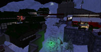
Snowlands Subcontinent
NOTE: THIS ARTICLE IS UNFINISHED. ESTIMATED FINISH DATE: JANUARY 1ST 2014
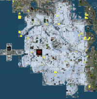
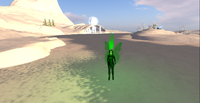
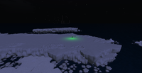
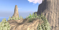
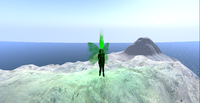
Snowlands is a Subcontinent located in Sansara. It is not the only place on the grid where Snow & Snowlands are found, but certainly is the largest one and the most known. All other snowlands together are smaller. Hundreds of pages have been written about Sansara and its snowlands. This article is written from a strict Geographic point of view. It reflects the situation of Snowlands in December 2013 and also it is written in a similar way to a touristic guide.
Geography
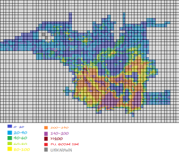
Snowlands cover a large surface and have one of the most interesting Geographic structures. Also, there are some transition areas. Here are all peaks higher then 200 meters on Sansara.
Main Snowlands
This includes the permanently ice-covered land. Everything here is white. It can be divided in 3 separated places: Chamonix, North snowlands and South Snowlands.
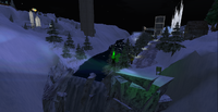
Chamonix is a peninsula to West, formed of 6 sims. It is a winter village.
North Snowlands are built with interesting Geographic features. There are many rivers. Interesting is that water is actually coming from Sutherland Abyss (see Dams for more information) and water altitude drops from sim to sim, creating waterfalls. Part of this water is navigable, part not. In Zermatt sim water is complete frozen, so you can walk along it. Altitude is usually lower, but that is not a rule. Declivity is very high. In fact, many mountain peaks have more then 200 meters high (see Altitude for a list). These very sharp peaks were detected by the drone that made altitude maps for Sansara. Results were unexpected, in contradiction with average values found anywhere else on the continent. There are also many lower places. Geographic fragmentation is very high.
South Snowlands are less differentiated and have some common features with all South Sansara. Large part is a high plateau. Altitude is high, but never reaches 200 meters. Average altitude is higher in South then in North, even if highest mountains are found in North and not in South. There are not many rivers. In South, oceanic shore can be visited (but it is not a good place for sailing).
Transition Land
This includes places close to the snowlands.
Tundra is found in East and in North. It is a place that is covered with permafrost. Vegetation is less developed and the influence from colder snowlands is visible. Usually, the tundra is in contact with river or oceanic water. Altitudes are high.
North Mountains are a a high natural obstacle between cold air from snowlands and warm air from the old world. They are the highest mountains in Sansara. Even if they are not covered with ice, they are strongly influenced by it.
Ice Sea is an inland sea, North-East to central snowlands. Icebergs are free-floating on its surface. It is a good place for sailing, but beware. You know what happened to Titanic.
Transportation
There is a large network of roads in North, less developed in South. Also, sailing is possible on limited surfaces. ONSR is a strategic railway in South. In some places, skilifts are present. There is an airport and flying is possible, by plain or by wings. Automated transportation is provided in many places: The ONSR has automated trains, there are skilifts that sometimes are functional (I don't know when) and most important there are Yava Pod Script vehicles on all the roads. They are found everywhere and offer free guided tours.
Sometimes, this is not enough. To visit other places, walking is required. Walking and flying are the only ways to visit high mountains.
Land Status
Snowlands have much Protected Land in North, while in South they have more Abandoned Land. Tourists must beware of Land With Restricted Access. Ban lines are present, but the real nightmare is the presence of aggresive entity orbs in some places. Even so, about 70% of all Inhabited Land has no restrictions.
Tourism
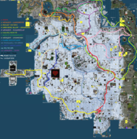
The following material contains proposed touristic routes. It is edited in a similar way to a touristic guide. Note that it was written in December 2013. Over time, changes will take place. All the routes proposed here are not official and not always on pritected land, but they can take you to the most representative parts of Snowlands.
- Tourist Route 1 - along the ONSR
- Tourist Route 2 - from ONSR terminal station to Ganymede dam
- Tourist Route 3 - up to mount Tethys
- Tourist Route 4 - close to the South oceanic coast and then to Chamonix
- Tourist Route 5 - from ONSR to Sugarolaf dam
- Tourist Route 6 - sailing in Snowlands
- Tourist Route 7 - the North tundra
- Tourist Route 8 - from ONSR to Chamonix, on road
- Tourist Route 9 - from ONSR to Kanin Mountains
- Tourist Route 10 - a paralell route to ONSR
- Tourist Route 11 - exploring the West of Snowlands
- Tourist Route 12 - the wild river in North-West
- Tourist Route 13 - from ONSR to Ross
- Tourist Route 14 - a small trip on alpine paths
Tourist Route 1
This is the most documented route and the only way we can go by train. Then, we continue a bit to South, by foot.
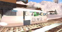
The ONSR is a historical and strategic railway. It starts in Wangen sim, near an airport and an infohub, then it goes South. Automated trains circle along this rail every 10 minutes, but you can also rezz your own train. Also, you can walk by foot or by car for a small part of the railway. Wangen railway station is a major orientation spot and the starting point for many tourist routes. Altitude is 92 meters.
A bit to North from the railway, there is Zermatt sim, with its frozen lake. But, we will talk about it in tourist route 2.
The train starts going, a modern, high-tech design maglev. We go South. The railway is close to the road. This is a large valley, surrounded by mountains. We can only guess how high these mountains are. But, today we don't climb them, we are here only to take the first contact with this ice-covered land. The river is at some distance from us.
And so, we arrive to Eagan sim. Here, the road passes over the railway on a high bridge. The railway is under the bridge. Then, we are between the road and the river. Here, the railway is so close to the water, that walking becomes dangerous. And if we look up, we see the top of some mountains higher then 200 meters.
Ohno sim is an important place. Here, the railway gets on the other side of the river. Then, it returns closer to the road. Ohno is the sim where the river enters from East, from the great Sutherland Abyss. You can come from Sutherland to here by sailing.
From here, we continue our jurney on the valley of a tributary river, to its water source. So, we arrive to Okemo Gorge sim. This station is the place where the road leaves to right and the river ends. We enter the Okemo Canyon. Altitude is 91 meters. From here, the railway is the only way forward. It is a wild place. This canyon separates two plateaus. Altitude starts decreasing slowly, while the railway stretches through this sharp valley, that gets larger when we reach the Okemo Canyon station and even larger in Nakiska.
Then the railway has to go down to Smithers Bluff. The train continues forward until it comes to a stop, then it goes backwords on another line. Then, at another end, it cnahges again forwards, to enter an even lower line. Finally, we arrive to Smithers Bluff railway station, close to ocean water level. A coast light is here. This station is also an orientation spot on our touristic guide. We walk along the water shore. Soon, we see a high mountain in front of us. This is the highest point in the area (95 meters) and allows us to see far around. The South oceanic coast is in front of us. All the buildings in the area are visible. This place is more populated then others in South, thanks to the railway.
Tourist Route 2
This is a good way for road lovers. Almost all this route is accessible by road.
We start our jurney at Wengen railway station, start point of the ONSR and tourist route 1. We follow the road and the river. A second road is visible on right. We enter Zermatt depression. There is a large plain to right. The river then vanishes for a few seconds and reappears completely frozen. We are now in the center of Snowlands. This large ice-covered lake is visible on every map. It is an excellent place for skating, even if a sigh warns us about thin ice. Nobody will stop you from having fun here. Also, this is an obstacle for navigation. Ships can arrive here from Sutherland Abyss, but there is no way forward. Anyway, even if one day the ice will vanish, there are waterfalls downstream. An island, in the middle of the lake, is a rezz zone and also a good place to see how high the mountains around us are.
There is another intersection. We continue forward, to enter a canyon. In fact, the road climbs up to the top, while the river almost vanishes. This is a populated area, with many buildings along the road. We enter Garmisch sim. Near the exit of this sim, two things catches our interest. First, in front of us there is mount Enceladus, one of the highest mountains on the grid. Second, at the sim border there is a small concrete dam that creates a waterfall.
At this point, we enter Arlberg sim. We are now in the tundra. Snow vanishes and all land is covered with permafrost. At the next intersection, we go left. Mount Tethys, the highest mountain in Sansara, is just left to us. To right, the river is close to us. We keep the river on our right.
We enter Tehtys sim. A set of massive rock buildings are visible all around us, on both sides of the road and on both sides of the river. The valley is a deep canyon. Then, once we enter in Mimas sim, we notice the presence of a waterfall. The valley becomes larger. We meet a high bridge, but don't cross it. We keep following the riger, through the tundra. There are more and more buildings and even gardens. We continue forward at the next intersection. Soon, the river flows into a lake and then we see a dam. This is Ganymede dam, our exit point from the microcontinent. From here, land is green and climate is temperate.
There is a similarity between Ganymede dam and Brighton dam in Sharp Continent. Even the canyon in Tethys has the same ground texture with the canyon in Svecia sim, even if it is much larger (see Mountains Of Sharp Continent for comparation).
Tourist Route 3
This route is for alpinists and it will take us up to the highest peak of Sansara. Before this , we must know that on the top of this mountain there is an entity orb that will not allow us to make a longer visit. Also note that it is impossible to climb to the top of this mountain. Wings are needed.
We start our jurney in Alberg sim, at the road bridge. From there, we start climbing in a straight line. It is very difficlut, declivity is very high and the terrain is anything but smooth. There is no path, just a general up direction. After a lot of climbing, we reach 246 meters in Davos. To left, not far, another peak is visible. It has also 246 meters high and is in Davos sim too. Gigantic Tethys mountain is forward and to right other mountains are visible too.
To continue our jurney, we go forward to Tethys. This will take us down to 210 meters. There is a deep hole in front of us, looking like a volcanic crater. Its depth could not be measured, it is too thin for an avatar to enter to its bottom. It separates sims Davos and Tethys and is the sharpest canyon on the whole grid.
At 231 meters high, we cannot climb further. We have to stop. From here, we start going to left, until we finally reach a more softer place to climb. That place is almost on the other side of the mountain. We continue climbing until reaching the top of Davos side of the mountain. Most probably, we get to 288 meters high, to a plateau named Anima Session. Tethys mountain is forward, separated by the very sharp canyon. We can go higher on a peak to left. We are at 301 meters high.
Here, we have to open our wings and get on the other side. We enter in Mimas sim. A good landing place is somewhere we see 3 trees on the mountain top. We are at 297 meters high. There is no way to climb up to here by foot, flying from Davos is the easiest way. We can get closer to Tethys mountain only until we reach the sim border. Ban lines block our access through and if we fly higher in air, an entity orb will certainly block us. Altitude is estimated at 315 meters high. We don't have measured this peak to its real size thanks to access restrictions.
From here, we continue our jurney to West, along the mountain range in Mimas and then we fall down North-West to the highway. If we don't have wings, a parachute is needed. The main risk is to fall in the canyon between Tethys and Devos, continued also between Mimas and Cortina.
Tourist Route 4
This is a way to visit the South coast. In the first part, there is no road.
We start from Smithers Bluff railway station. We follow the railway over two bridges until we get inside the trainyard. There, the rail ends at a sign under construction. This is the sign for us to go forward.
We continue going forward over the snow. There is no road. No touristic marks can be seen and we are free to select the way. The best and only orientation sign is the ocean that always must be to left. When an obstacle is in front of us, we turn right and climb higher in the plateaus.
All the area is an alternation between inhabited land and abandoned land. There are a few parcels that use ban lines or entity orbs, not many. There is enough unused land for us to keep on walking. At some point we find a valley, then, inside a forrest, another valley is in front of us, with a stream flowing to the ocean. This is a long and exhausting walking adventure.
In sim Auschnar Run, at an altitude of 82 meters, we meet a road. To right, an avalanche closed the road. To left, this is our way out. Two ice arcades show us the way to go. This is Amundsen Road and it takes us away from the ocean shores. We keep on climbing. Finally, at 115 meters high, we are on the top of this frozen plateau. We follow this road until the next intersection. A sign tells us that if we go left, we reach Chamonix City. This is the route we fill follow to find a warm place for our frozen legs.
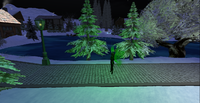
To get to the city, first we get down from the plateau and then we pass over a long bridge. Many welcome signs are all over the road. Then, once we enter, luminosity change to a dark blue, similar to the polar day-in-night. The road takes us through a forest and then we enter the town. Buildings are close one to the other and always close to the road. The town is big and interesting. Sure we can find a warm place here and some warm food, even a place to sleep. But first, we continue our route. The road ends in Cross Check,where we enter a park. Now, we see that the city is placed in a depression. When we leave the city, we enter the Chamonix low mountains. We are in Breakaway sim, near a frozen lake, the best place to play hockey. There is a campfire just on ice surface, near an ice house.
Tourist Route 5
This is the way to get from Wengen railway station to Sugarolaf Dam, out of snowlands. There are two ways to go to the dam: one way is by road (can be done by car, except for the last part) and the other one is by foot, over the mountains.
1. By car, we start from Wengen railway station and continue to North, to Moritz, near Zermat frozen lake. We go right on the first road we see. The road climbs to 115 meters, then enters a small canyon and soon we are on a plateau. A church can be seen on left and a forest on right. Then, we go down and at an altitude of 65 meters we find an intersection. The road to follow is the one to right.
Now, we are close to Ice Sea. Water is highly visible to our left. The sea will be described later, at touristic route 6, the only way by water. At this moment, we just watch it from the road. There are many inhabited parcels along the road. Buildings are frequent and so are the forests. Altitude is between 80 and 90 meters, until we find some unconventional sky-scrappers and enter a small canyon, in Gourdeneck sim. We are getting closer to the dam. A road is visible to right. Here, we leave our car and continue by walking. We start climbing the mountain between the two roads.
The mountain is 125 meters high. By climbing, we leave snowlands behind and enter the tundra. We walk on permafrost. On the top of the mountain, you can see a pagin altar and some robots. From here, we continue forward and a bit to left. We start slowlly to go down, to see the river falley left to us. Soon after we entered Sugarolaf sim, the dam starts to become visible. Grass coveres the land, we are out of the tundra. We finished our trip. The dam has no road access, so it is a much more quiet place then Sutherland Dam. Both Dams have the same heigth and both are the highest dams on the grid. If we go accross the dam, on the other side, there is a rezz zone for boats. From here, we can return to Snowlands by water (see tourist path 6).
2. By foot, we start from the same place, Wengen railway station. Just accross the road, there is a skilift terminal. The skilift helps us climbing the mountain (if it is functional, usually it isn't). Altitude is 202 meters at the other terminal. Left to us, the mountain isvisible and awaiting alpinists. It is not very difficult to climb it, mainly because we start from 200 meters. Mountain top is at 255 meters. This place is at the border between two sims, so one quarter of the mountain is on skilift land, one quarter is protected land, one quarter is abandoned land and finally the last quarter is on a parcel named God's meeting spot (in Rogla sim). The last name might be a correct one, since anywhere you look you can see only the blue sky and almost no piece of land.
To continue, we walk to East, through Rogla sim. First, we get down from the mountain top (there is also a building in rogla). We follow the mountain range that will take us into Toggenburg sim. This way, we enter a skirun. Altitude is 180 meters. A device is counting the number of visitors (and there were more then 300 000 until now). We walk now along the mountain range, where altitudes are between 170 and 190 meters. Everything is protected land. In Anzere sim, the mountain top is at 200 meters (and still protected land). A few constructions are visible to left.
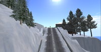
Here, if we turn left, we can go to the dam on a shortcut, but much more interesting looks what we see in front of us. If we follow the mountain range, we will reach an even higher mountain. So, that is the way to go. We pass through some parcels of abandoned land. Then, finally we arrive closer and start climbing. It is very easy to get to its top. This is Mount Moen, 245 meters high. This is the start point of a ski run (to our right). To left, some buildings are visible, including some Japanese homes. To continue our jurney, we must go to left (East), avoiding the buildings.
A good way to get down is through a small valley in Takalo sim. After a while, we leave snowlands and enter the tundra. Sugaroglaf lake is visible in front of us and so is the road. This road must be followed to left, along the lake shores, at an altitude of 107 meters. It takes us back into the snowlands for a while. Constructors prefered to avoid the shores and to build the road much higher, so in Duck sim we climb to 115 meters, then we return to a lower altitude. The road goes forward, while the shore turns right. Here, we leave the road and start following the shore. Snow soon vanishes and after 200 meters the dam is visible in front of us, surrounded by grass-covered mountains.
Tourist Route 6
For this route, a boat is required. If not, swiming in freezing waters might be a lethal experience.
A rezz zone is inside the river in Ross sim. Of course, the river flows into Ice Sea, that is connected to the ocean, it is intercontinental water, so you can arrive from anywhere. Soon, from Ross, we enter Refugio sim. Icebergs are visible. First ones are very small, the other ones are larger. As a good sailor, you must remember what hapened to the Titanic, so don't get too close to the ice (even if they are not moving). Walking on their surface is usually not dangerous, but sometimes there can be soft snow on top of them. More and more icebergs can be seen. In Barents, a wooden ship is abandoned and stocked in the ice. This place is The Crows' Nest. We continue to sail through the ice. On right, the shore is ice-covered now. In Laptev, a few objects are stocked on the ice. They could be all what is now left from the first explorers that vanished in these cold waters.
And then, like from nowhere, ice vanishes and the shores are covered with grass. We arrive in Orient sim, where we can see the river flowing into the see through a deep valley. We turn right and sail upstream. A high bridge can be seen from beneath. There are a few buildings along the river. The valley is not anyhow bot not large in Sugaroglaf sim and it becomes very difficult to sail here. If sailing is no longer possible, we can continue by foot. Anyway, no boat can climb the dam, so we have to leave our boat here. There is no rezz zone downstream, but upstream, on left, there is one. This is why it is much more easy to go upstream then downstream.
We rezz a boat here, on the lake. then, we start sailing along the shore we see to right. We soon arrive in Duck sim, where left shore is covered with grass and right shore is covered with snow. Water here is so deep, like in Sutherland Abyss. On right, the shore is no longer covered with ice. Buildings and vegetation can be seen all the way along the shore.
In Miller sim, we see the moutn of a river. This is the way to Snowlands. We leave the lake and continue sailing along the river, under a bridge and between mountains. First, sailing is very easy, but starting from Chaska, the valley is not wide enough for big ships. That is bad news, it means that if your ship is too wide, you have to continue by foot. On the right side of the river, there is a terrace that can be used for walking. But, our boat is small. And so, we enter the snowlands. From Chaska, all land is frozen and covered with snow.
Soon, we enter Ohno sim. In front of us, there is the ONSR railway and nearby we can also see the road. Our river meets a tributary coming from left. Sailing is possible with small boats on this river up to Benham. We follow the main river downstream to Wengen, to the ONSR terminal station. From here, water is frozen and we cannot continue downstream. This river drains water from Sutherland Abyss through the snowlands and then down to Ganymede dam.
Unfortunately, there is no rezz zone along the river inside Snowlands. Sailing is possible only in one way.
Tourist Route 7
This route is a difficult one. There are no roads (except for a small distance) and flying is the only way through in some parcels.
We start in Mimas sim, at the bridge. Forward, we see the gigantic shape of mount Tethys to left and Enceladus to right. This is the deepest canyon in Sansara. We use the bridge to get to the other side. Soon, we enter Janus sim. Forsets can be seen to right, on the mountain we want to climb. We leave the road and start climbing. We reach to an altitude of 120 meters, where we stop. Almost all this mountain is covered with trees. We can try moving around the mountain in circles, but even so, we will not get to 150 meters. Flying is not allowed, except for a small parcel on the other side of the mountain, but that is the only way froward.
Mount Janus is 187 meters high and it belongs to Praetorium Of Janus. There is a crater on the mountain top and trees are all around. Landscape is interesting. The nearby high mountains of Tethys and Enceladus are visible and they look so close, even if they are far away. In the opposite direction, we cannot see too far, but that is where the warm climate of Northern Sansra.
We leave the mountain top and continue our jurney to Enceladus sim, to its mountain peak. This means to go down all the way we climbed. We will go down until we reach a river. Water here comes from Sutherland Abyss, through Snowlands. So, it is very cold. We see a waterfall here, this is an orientation spot.
Now, we start climbing mount Enceladus. Even from the beginning, it prooves to be a very difficult task. Obstacles are anywhere. We find a small terrace at 70 meters high, then a larger one at 100. Another one is at 168. Climbing is possible only on the North part of the mountain, in South (Tethys sim) it is really impossible. But even so, 194 meters is the maximum altitude we can climb by foot. To continue, wings are highly needed. Mountain surface is as slippery as if it was made of glass. This peak is inside Tethys sim. We are at 257 meters high and the huge Tethys mountain is right in front of us. Mountain top is a very rough plateau. The most interesting part is that the highest surface of this mountain is in fact in Enceladus sim (that is why it is called Mount Enceladus), while the highest peak is in Tethys sim (so it is called North Tethys). This is a good place to relax.
We continue our jurney to West. For this, a parachute is required, to jump from this high peak. From here, the way is to follow the mountain range to North (it will take us to altitudes of 163 meters). If we follow the mountain range, there are a few parcels that don't allow us to enter. After a while, land is again covered with snow and we see a road. This is our way forward. We follow the road to left. If we go right, the road will take us to Wengen sim, start point for majority of touristic routes. All the way, this road is the border between snow-covered land and permafrost. There are buildings along the road. This is a populated place.
Then, in Whiskey sim, there is another road to left. We take this road for 100 meters, until we get to a bridge. A small stream comes from the snowlands and falls into the river. A warning sign says bridge may be virtual, but it prooves to be solid. Right to the bridge, about 100 meters downsteram, there is a waterfall. Then, we enter Ross sim. We are in a deep canyon. There is a small bridge in front of us. This marks a rezz zone for boats. Also, this is the starting point for touristic route 6, the only route for sailors in Snowlands.
Tourist Route 8
This route connects Wengen ONSR terminal station to Chamonix. It uses almost only roads, but for small sectors you will have to go off-road. So, a land rover will be good for this. Very useful might be a motorbike or a horse. Of course, you can go by foot.
We start our jurney in Wengen sim, near the rialway station. From here, we go north, along the road, to Zermatt (see tourist route 2). This is the place we meet Zermatt frozen lake. We leave the road and start driving on ice. On the other side of the lake, we find the end of a road.
This road is named Alpine Trail and it is paved, large enough only for a single car. There are trees and buildings anywhere around us and many places where we can stop to relax. At some point, a huge ski line is visible to left. We walk along a small river.
In Durango sim, it looks like the road ends. In fact, this it a bridge made of light. We touch the sign and the bridge rezzes itself. It is a low-glowing structure that vanishes once we passed away. And so, we pass the small river and we climb to Amudsen road. This is the way to go forward to Chamonix.
Amudsen Road connects Chamonix with Tethys. So, if we go forward, we will soon see Tethys mountain in front of us and we can continue to drive until we get closer. Then, we reach touristic route 2. If we go back, we will travel on a wide plateau, until we see the intersection to Chamonix (described at tourist route 4).
While we continue our jurney to Chamonix, we drive over a bridge, then altitude rises to 146 meters high. There are two mountains left to us (will be described later). After we pass the mountains, a small road is visible to left. We continue our driving over a frozen plateau, at an average altitude of 115 meters.
Tourist Route 9
This is a route for walking (not recommended for vehicles). This is the way to have a closer contact with the mountains seen from train (described at touristic route 1).
Our starting point is ONSR terminal station in Wengen, at 91 meters high. We leave the road behind and start walking directly to West, to the river. There is a place where the river is frozen and we can walk on ice to the other side. To left, we see the end of a road. To right, there is a skilift. We use the lift to get forward (or go by foot if it is not functional). This takes us to Kanin sim, the end of the skilift, at 262 meters high, between two mountains.
1. If we climb the mountain to our left, a sign says prepare to die so we prepare ourselves and continue. It is a difficult task to climb it, but not impossible. We reach an altitude of 310 meters. We are on top of mount Kanin. This is the second high mountain of Sansara. Landscape is interesting. We can see other two mountains forward. We can explore them. So, we go forward, to the nearest high mountain. This means that we go down to 281 meters, to a high pass, then we start cllimbing again. This is Mount Bydalen (308 meters). But another mountain is visible forward. To get to it, we must go forward and down, reach 202 meters and start climbing. To left, there is an iluminated ski run. This second mountain is Bydalen East, 262 meters high. From here, we can continue forward, back to Wengen railway terminal station. In fact, if you start climbing directly from Wengen and don't follow the skylift, this is where you will arrive.
2. If we climb the mountain to our right, we find a very sharp mountain range (better to walk on the left part). Soon, we arrive at Mount Kanin (294 meters high). Then, we continue to West, going down to 195 meters. A mountain range is visible in front of us. It is not a good idea to walk on it, ban lines will stop you. Much better is to walk a bit to right, to the end of a high-speed ski run (it ends near the alpin trail described at touristc route 8) and then go down along it or on it. Another way to leave this place is at 210 meters high to turn left, through a valley. This will take us on Amundsen Road, between the two mountains we seen on the road (see touristic route 8). We can continue now walking to Chamonix.
Tourist Route 10
This is an alternative way to go from Smithers Bluff to Wengen, through the mountains West to the railway. Except for a small sector, there are no roads. All this trip can be made by foot, but on small sectors, access is possible with a motorbike. A horse can travel almost all the way.
We start our jurney at Smithers Bluff, South terminal station of ONSR railway. Then, we go North, along the railway, to Nakiska station. If we decide to take a shortcut, we can see a few unknown landscapes, like a frozen lake, a hidden house and we can climb Wickentower Hill, 68 meters high, a place where the railway is clearly visible. No matter the way, soon we reach Nakiska station, a place a bit to left from the main line. This is the point we leave the railway to right and start climbing the mountain in front of us.
We soon reach the plateau, with altitudes between 115 and 130 meters. There is a lot of abandoned land, buildings are visible only from place to place. Walking along this is very easy. These large plateaus with small hills were experimented here for the first time. Then, they were added to the construction of all South Sansara and later they become the most important feature for all new continents. The landscape we see here can be found also on Jeogeot, Satori or Corsica and like here, there is a lot of abandoned land.
On the plateau, we have two choices. We can travel forward, to enter a large plateau with many buildings and even a forest. Without any orientation points, we will lose our way soon in here. There are no roads, no mountains, only if we go too much to right we can see Okemo Canyon and the railway. Altitude is 100 to 120 meters. The second and the best choice is if we go West, where we can find a road. To get there, once we climbed on the plateau, we look for a glass building and go in that direction. That building (131 meters) is the highest point. If we keep going in that direction, soon we find a road inside a small canyon. It has even a rezz zone. On this road, we enter Virrat sim. There are many buildings along the road, even if it is not connected to the main road network. It ends in Coldmount sim.
We are at 125 meters high, at the end of the road, in a rezz zone. From here, we can continue our climbing with a land rover or by foot, but not for long. Soon, declivity increases over 50%. We continue by foot. After a hard climbing, wo enter a place with high altitudes, but not so difficult for climbing, something between a mountain and a plateau, covered with forest. To right (East), there is a pink sphere. It is protected land. We can enter directly inside the sphere.
This sphere is top of mount Cloudmont and is an orientation spot. From here, we can go left or right along this mountain. So, we have to variations for our path.
1. If we go right (East), we can get down from the mountain and enter a large forest, in Purden sim. We keep going forward through the woods. Then, at some point, another mountain will be visible in front of us. With a maximum altitude of 222 meters, mount Jaffee is a hard task for climber because it is rough terrain. Even so, the landscape makes it worth the trip. Cloudmont is vissible behind us.
From Jaffee, we can continue our journey forward. We will go down into Ohno or Eagan sim, to meet the ONSR station down in its canyon. If you wish to start from here, just from the railway station in Eagan, get accross the road and start climbing the mountain, then continue to the pink sphere in Cloudmont.
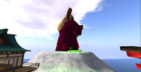
2. If we go left (West), we continue along the mountain range. Altitude drops a bit below 200 meters. To right, there is a deep valley and a mountain can be seen too. We continue forward. Soon, new mountains will become visible, including one with a high statue. This is Silk Waters Mountain (210 meters), Verbier sim. This is a Buddhist community and the statue is a monk from Tibet. It worth exploring.
From here, we go a bit to right, to another mountain peak that is visible. To get there, we will have to travel some distance. We meet a small mountain road and soon we see a Chinese pagoda. There is an entire Buddhist monastery in front of us, with a huge statue of Buddha. We can climb it and visit, or we can find an alternative route to left or to right. More interesting is to go through. For a Geograph, almost all the monastery is built at 201 meters high (there is a small spot at 203), on a flat plateau that can be considered Mount Livigno. There is even an ambassy from the independent state of Caledon, Caledon - Winterfel continent.
We leave the monastery behind and continue forward. there is a Gay dungeon (we pass and leave that behind too), then we see in front of us Kanin mountains. They are in front of us. We enter Byladen sim and mount Byladen is straight in front of us. If we go a bit to right, we find a ski run and not far from here we see the skilift that comes from Wengen. Here we meet tourist route 9. We take the skilift (or just go down on the skirun) to reach ONSR station in Wengen.
Tourist Route 11
This is a task for people with some orientation skills. There are a few roads, but unconnected to the main road system and in many places there is nothing but an endless white plateau.
We start in Auschnar Run, a sim in South-West, close to tourist route 4. This is the last place that can be reached by car along Amundsen Road. From here, we continue North. The road was destroyed by a massive avalanche. From 86 meters high, it has fallen to 47. inside a deep canyon.
We follow the road along a river, in Loveland sim, then in Bretton, where it starts climbing. Soon, it ends, covered with snow. If we continue forward, the canyon ends and we soon climb up to the top of the plateau, at 100 meters high.
Until recently, the best way to continue the trip was through Pando sim. currently, even if it hosts one of the most beautiful winter gardens, it has an entity orb, so it can no longer be used as a transit area. Currently, the best way is to go through Reperes, a parcel in Bretton sim. Land is covered with a green material, visible on the map. Then, go to right, avoiding Pando sim. We must get to the lake in Boreal sim. All the area is a maze of protected land, abandoned land, unused land and inhabited land (with or without restrictions for access). It is impossible to make a guide like: walk 3 steps left and 4 steps right because things change from time to time. There are a few paths in Hanson that might be useful, inside a park. A road leaves to West to Amudsen Road (not to be followed).
Lake Boreal is at 116 meters high. It is not frozen and birds can be seen on its surface. Around the lake, Arosa village is a friendly mountain community. It worths visiting this place only for the landscapes around. Also, mount Kanin can be sometimes seen to right.
From here, if we continue forward, we will soon reach Amudsen Road, close to the intersection of tourist routes 8 and 9, in Kendall sim.
If you decide to start from Kendall, there is a road that allows vehicles to approach the lake.
Tourist Route 12
This is the way to meet the most wild of all rivers in snowlands. It is a difficult task. There are no roads and water is freezing to death. So, before everything, get prepared.
We start in Durango sim, on Amudsen road, at the intersection between tourist routes 8 (variations 1 and 2). Here, we start walking along the river. Just below the bridge, there is a rezz zone for ships (you can travel by ship only a small distance, to Zermatt frozen lake) and a waterfall. That is what blocks navigation downstream. Just below the waterfall, on the right side, we can see a small artiphicial terrace and a bible.
From here, water altitude is the same with the ocean. The river flows through a deep canyon, the only way to go forward is up, on its top. Everywhere we are in risk of falling in the frozen waters. Soewhere, downstream, a wooden bridge can be seen, while upstream, on the plateau, a garden is close to us. Right there, in the garden, we can find the highest spot: 148 meters high.
There are many buildings and access restrictions. It becomes a difficult task to find a way through them, without falling in water. If you wall, the shores are so high that climbing back is impossible. But, if we keep on, we will reach Rosa sim, with much abandoned land. A peak (119 meters high) is good for a landscape. Here, we can see the river flowing into the ocean and also the fact that we are on a peninsula. Then, an isolated building marks the end of Rosa sim, at 130 meters high.
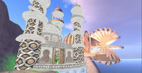
From here, we see a building with strange architecture to right, in Nonantola sim. This is Ice Queen Area. This building is inspired from the Arab world, but has many elements from the cold environment of the Snowlands. Downstream, we can see the incredible: a tropical island (but it is for sale, so it might vanish soon).
To continue our jurney, we need to get accross the river. There is no boat rezz zone, the only way is to fly or swim (difficult in these freezing waters). We start climbing on the other shore on the only way that allows climbing. Upstream, canyon walls become almost vertical. We arrive on a small mountain range (82 meters). From here, we go South-East, through a depression. We start climbing again, in Scorze sim. There are a few vertical walls that forces us to search for better paths. Finally, we reach Amundsen Road in Jiminy sim, close to a freebie shop.
Tourist route 13
This route will take us from Wengen, ONSR railway station, to Ross, the rezz zone for boats in the Ice Bay. Basically, it follows a road. A car can be very useful, but in some places we can make small walks on foot.
We start in Wengen and drive North, through Zermatt, to Anton sim. This is an intersection where we take the road to right. This is a hard climbing for every car. It doesn't take much and we reach the maximum altitude of 198 meters. The second highest road is in Mountains Of Sharp Continent, 191 meters. We leave our car here and explore the mountain to left, It is a flat plateau with many buildings. Highest altitude is 206 meters. This is Mount Koss.
We return to our car. From here, we can see sometimes far away mount Bydalen. The road takes us down to altitudes below 130 meters, in a plateau. There are not many buildings around, this place looks abandoned.
At 129 meters high, in Rotherburg sim, road turns to left. If we go left, the road will take us to tourist route 7. We can take a shortcut, but this will mean to leave our car. If you like riding a horse, this means no problem. Where the road turns left, we turn right. We soon reach another road in Refugio sim, at 68 meters high. We follow this road to left and then we take the first road to right, to a large bridge. We are close to Ross boat rezz zone.
Tourist Route 14
This is the most easy route of all. It is short and almost only on roads and paths. They are made for walking or rideing small vehicles. These are the touristic paths the Linden authorities have made for us. They don't form a single route, but for simplification they have been grouped in a single chapter, under multiple sub-chapters (named variations here).
We start from Wengen sim, at the railway station. We walk accross the frozen river. On the other side, there is a starting point for a road, to left. On right side, there is a skilift (described at tourist path 9). Also, if we go right, we enter a small path, described at variation 1. There is also a rezz zone for vehicles. This is a paved road, large only for a single car. It takes us along the river, paralell with the ONSR line. In Ayas sim, we see a path on right. We will talk about it later, at variation 2. Another short path connects the alpine route with a club.
We enter Orelle sim (112 meters high). Here, pavement ends and we start walking on a path. To left, a Japanese, Chinese or Tibetan town is hidden behind walls. Another one can be seen up, on right. We wnter Silk Waters Mountain. Climbing is more and more difficult, until we reach the top of the mountain, at an altitude of 175 meters. Here, we meet tourist route 10.
On the other side of the mountain we find an intersection. To right, the path ends soon. To left, it continues forward and soon we find another intersection: a path to left and one forward. If we go forward, we enter variation 3. If we go left, we will soon climb back to the mountain top and to ONSR railway. This is the way to continue our journey. We enter back in Orelle sim and at an altitude of 132 meters the road is paved again. We enter back the town. Walls are both on left and on right.
Next sim is Meribel, a place with many buildings. Then, we reach Eagan sim. Alpine route ends here. The ONSR railway is in front of us, near the main road. Now, all we need is a train to take us back.
1. Basically, this is a path that follows the base of Kanin Mountains. The path starts in fact in Zermat sim, from the alpine route described at touristic route 8. We can take a shortcut from Wengen ralway station (we go accross the river and then we start walking to right, along the shore until we find the path) or directly from Zermatt (we get accross the frozen lake and find the path on the ohter shore). The path ends in Seefeld sim, at a paved alpine road, described at tourist route 8. From any point along this path, we can start climbing Kanin mountains.
2. This is another path. It starts in Ayas sim and follows a valley. It ends at 138 meters high, at border with Voss sim. It is continued with a skirun, that finally ends at some point. If we continue climbing, we enter Bydalen sim and stop at East Bydalen mountain, 262 meters.
3. This small path connects the main alpine route to Silk Water Mountain, the highest peak in Verbier sim, 211 meters, at a high statue of a Tibetan monk (also described at tourist route 10). It has 150 meters long.
