File:Slrr-Final.png

Original file (2,430 × 2,090 pixels, file size: 845 KB, MIME type: image/png)
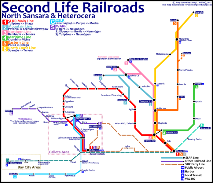
Schematic map of the Second Life Railroads, indicating most passenger routes and services. Depot and sidings are not represented.
This map is updated as of September, 2012. Added features to my older map : WARR expansion in Hera and Neumögen, Eastern line expansion and branching in the North Coast Line. Added automated ferry services to Bay City and the East Coast.
You may use, edit and distribute this file for any non-commercial or commercial purposes. You may not, however, sell it as it is for any amount of money - this map is free.
File history
Click on a date/time to view the file as it appeared at that time.
| Date/Time | Thumbnail | Dimensions | User | Comment | |
|---|---|---|---|---|---|
| current | 10:22, 17 September 2012 | | 2,430 × 2,090 (845 KB) | Balthazar Lindman (talk | contribs) | Fixed mistakes |
| 09:27, 16 September 2012 |  | 2,430 × 2,090 (808 KB) | Balthazar Lindman (talk | contribs) | Fixed wrong line heading | |
| 09:24, 16 September 2012 |  | 2,430 × 2,090 (809 KB) | Balthazar Lindman (talk | contribs) | ||
| 07:46, 16 September 2012 | 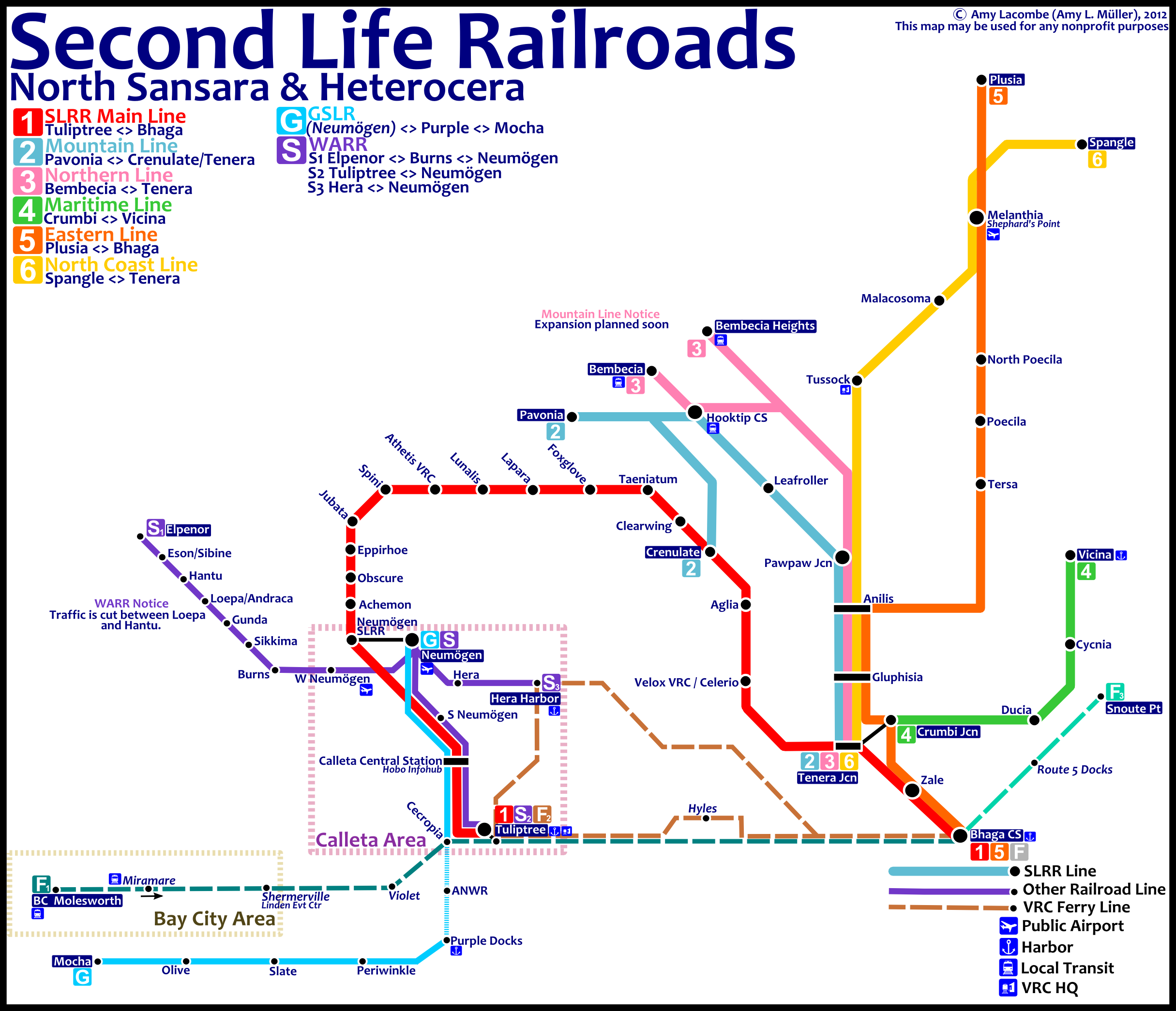 | 2,430 × 2,090 (809 KB) | Balthazar Lindman (talk | contribs) | Schematic map of the Second Life Railroads, indicating most passenger routes and services. Depot and sidings are not represented. This map is updated as of September, 2012. Added features to my older map : WARR expansion in Hera and Neumögen, Eastern li |
You cannot overwrite this file.
File usage
There are no pages that use this file.