File:Bay-City-Map-Full.jpg
Revision as of 14:16, 9 June 2012 by Marianne McCann (talk | contribs) (uploaded a new version of "File:Bay-City-Map-Full.jpg": Trying this again. Upload did not seem to "take" last night. May delete if this one doesn't and start over.)

Size of this preview: 800 × 413 pixels. Other resolution: 3,000 × 1,548 pixels.
Original file (3,000 × 1,548 pixels, file size: 1.11 MB, MIME type: image/jpeg)
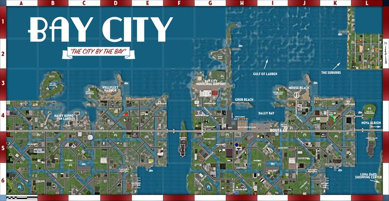
A map showing the complete, unified Bay City, generated in June 2012 for the SL9B event
File history
Click on a date/time to view the file as it appeared at that time.
| Date/Time | Thumbnail | Dimensions | User | Comment | |
|---|---|---|---|---|---|
| current | 14:16, 9 June 2012 |  | 3,000 × 1,548 (1.11 MB) | Marianne McCann (talk | contribs) | Trying this again. Upload did not seem to "take" last night. May delete if this one doesn't and start over. |
| 23:55, 8 June 2012 |  | 3,000 × 1,548 (1.11 MB) | Marianne McCann (talk | contribs) | (No, Mari, there are not two Bay City Fairgrounds: remove that label!) | |
| 23:41, 8 June 2012 |  | 3,000 × 1,548 (1.12 MB) | Marianne McCann (talk | contribs) | A map showing the complete, unified Bay City, generated in June 2012 for the SL9B event |
You cannot overwrite this file.
File usage
There are no pages that use this file.