Difference between revisions of "Western Ocean"
| Line 1: | Line 1: | ||
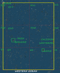
[[File:Western Ocean New. | [[File:Western Ocean New.png|200px|thumb|left|Western Ocean]] | ||
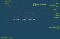
[[File:South - Western Ocean.jpeg|200px|thumb|right|SW Ocean, previous version]] | [[File:South - Western Ocean.jpeg|200px|thumb|right|SW Ocean, previous version]] | ||
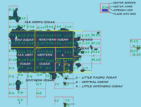
[[File:Grid Oceans.png|200px|thumb|left|Oceans, oct 2013, click for large]] | [[File:Grid Oceans.png|200px|thumb|left|Oceans, oct 2013, click for large]] | ||
Revision as of 12:26, 25 October 2013
Western Ocean is a part of the grid. On previous edition, Western Ocean was too large, including about 40% of all private-owned land. Its borders were also not well defined, so it swallowed the South-Western Ocean. Now, it is divided into Far West Ocean and Western Ocean.
Previous Info
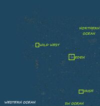
Western Ocean was defined as West to South-Western Ocean. It is separated to East by Eden and Irish - Bonaire continents, while in North, the boundary is the Wild West continent. It could include the Remote South-Western Sea. In practice, however, continent detectors that used these coordinates (see ContinentDetector) included half of the grid into this ocean.
Borders and coordinates
Small continents are not visible from world map at lowest resolution. So, this time borders are fixed using the largest private continents, Eden and Caledon - Winterfel. Eden is at the corner of Western Ocean, Northern Ocean, North - West Ocean and Far West Ocean. Borders are now fixed as follows:
- To West, a line that goes through Eden Continent
- To East, a line that goes through Caledon - Winterfel
- To North, a line that goes through Eden Continent
- To South, a line that goes through extreme South of Jeogeot.
Overall coordinates now are: 680-1067/900-1200.
Grid Sector: F9, F10, F11, G9, G10, G11, H9, H10, H11, I9, I10, I11. However, it coveres only a small part of 6 grid sectors, so overall surface is about 7 grid sectors.
Geography
Western Ocean has a high sim density and no void gaps. It is full-packed with sims. It also hosts some private continents.
Structures
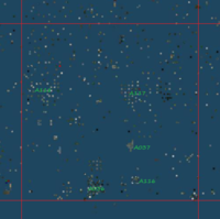
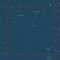
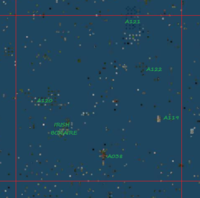
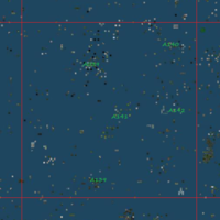
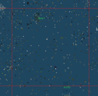
- Grid Sector G9, coordinates: 700-800/900-1000, sector full of sims
- A036 - Sim Cluster - 736-747/900-914
- A037 (Seduction) - Microcontinent - 760-762/928-934
- A116 (Antiquity) - Microcontinent - 762-766/910-913
- A117 - Sim Cluster - 757-784/951-972
- A118 - Sim Cluster - 701-723/954-980
- Many Unassociated Sims detected
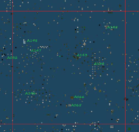
- Grid Sector G10, coordinates: 700-800/1000-1100, sector full of sims
- A038 - Microcontinent - 751-755/1010-1019
- A119 (Wastelands) - Microcontinent - 785-788/1036-1039
- A120 - Sim Cluster - 703-732/1043-1056
- A121! - Sim Cluster - 765-777/1083-1105 - North sims are blue
- A122 - Sim Group - 773-779/1061-1077
- Irish - Bonaire Continent
- Many Unassociated Sims detected
- Grid Sector G11, coordinates: 700-800/1100-1200, sector full of sims
- A067 - Sim Cluster - 730-736/1183-1194
- A121! - Sim Cluster - 765-777/1083-1105 - North sims are blue
- Majority of this sector is formed of Unassociated Sims. Part of the sector could be separated into 3 sim clusters, but their borders are difficult to separate
- Grid Sector H9, coordinates: 800-900/900-1000, sector full of sims
- A137 - Sim Cluster - 880-903/905-918
- A138 - Microcontinent - 823-825/981-983
- Uhre Continent
- Majority of islands are Unassociated Sims
- Grid Sector H10, coordinates: 800-900/1000-1100, sector full of sims
- A039 (Isles) - Sim Cluster - 832-851/1068-1092 - sim cluster and isolate sims
- A139 - Microcontinent - 839-844/1006-1011
- A140 - Sim Cluster - 840-893/1081-1101
- A141 - Sim Cluster - 846-862/1034-1054, formed of two green sim clusters
- A142 - Microcontinent - 879-883/1048-1052, Japan tropical beach
- Many Unassociated Sims detected
- Grid Sector H11, coordinates: 800-900/1100-1200, sector full of sims
- A032! - Sim Cluster - 694-701/1120-1128
- A065 (Zenshi) - Microcontinent - 850-852/1116-1118
- A066 (Western) - Microcontinent - 852-854/1122-1124, (access only with themed clothes)
- A143 (SkyBeam) - Microcontinent - 854-860/1157-1163, two microcontinents
- A144 - Sim Cluster - 869-884/1141-1164, sims with mathematic disposition
- A145 - Sim Cluster + Microcontinent - 877-892/1180-1193, sim cluster with two microcontinents
- A146 - Sim Cluster - 800-836/1113-1143, diffuse sim cluster
- A147 - Sim Cluster - 808-833/1149-1170, diffuse sim cluster uncomplete divided in two
- A148 (Key, Bay, Island) - Microcontinent - 810-811/1172-1175
- Many Unassociated Sims detected
Divisions
Sim density is almost homogenous. There are two continents inside the ocean, but if we divide it into smaller basins, this will create confusions. Also, Irish - Bonaire lost a lot of its sims. If this process continues, soon it will become a microcontinent. The only suggestion might come from the independent state of Caledon[1], who talk about their waters. So, a few sims around Caledon - Winterfel can be included into a small sea.
Overall
Inside oceanic waters, there are a few continents, like Irish - Bonaire and Uhre Continent, while Caledon - Winterfel and Eden are at oceanic border. There are 13 sim clusters (2 of them extend from a grid sector to another). 12 microcontinents could be found, all of them are themed. One structure is complex (both a sim cluster and a microcontinent).
A119 (Wastelands) is a remnant of human civilisation, with toxic lakes, abandoned buildings and ruins.
Many places are paradise tropical beaches.
